
For part one of this series, see Paradise on the Platte.
The epiphany of the cranes and the Great Interstate Archway provided energy enough to put on a few more miles that first night. From Kearney, I headed south and west through Axtell and Funk to Holdredge, where I paused to gas up.
After being nailed by a heavy downpour on I-80, I was wary of the fact that thunderstorms were developing in several directions–it’s one thing to be engulfed by one in the daylight, but quite another at night, on hilly, dark two-lanes full of truck traffic out on the High Plains. The young man at the filling station took my snack money (you pay at the pump after dark) and said, “be careful out there,” which, considering the lightning crackling to the north, I took to refer to the weather and not anything sketchy about the town itself.
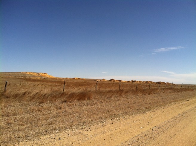
South from there on 183, over twenty miles of dark road and lightning on three sides to Alma, on the Republican River and near the border. There are several motels there, but I didn’t want to stop until Nebraska was behind me, so on I went over the river and into The Great State of Kansas. From there, I picked up 383, a diagonal state highway marked with the ubiquitous golden sunflower (that, I’m sorry, looks like an amoeba when it’s stretched to encompass three digits), running along Prairie Dog Creek through the northwest corner of the state.
It was dark, and concentration was flagging. I can see well enough driving in the dark, but my eyes wearied of watching for deer, and oncoming headlights were making it worse. A semi came up behind me; the road was winding; there wasn’t anywhere to pull off. Even after adjusting my mirrors to cut the glare, it was obvious I was just going to have to hole up in the next available place.
Thankfully, I spotted a water tower ahead, and a neat-looking little town just off the highway–well-lit and promising a bed for me. I slowed; the semi passed me, and I was executing the turn before I saw the sign: “Norton Correctional Facility.” Oh, hell. Probably not the bed I was looking for! But, where there’s a prison, there’s a town for its workers to live, and I found that and my rest just a couple more miles down the road.
High wind warnings for the next day drove me out early and without breakfast–just a couple cups of mediocre motel coffee and the belief that I’d find interesting food somewhere down the road. The idea was to stick on 383 southwest, then hook up with 83 down to Oakley, before turning west on 40 and into Colorado, toward the Sand Creek Massacre site.
Or, maybe I’d go further south on 83 and check out some points of interest before picking up 96 west. Either way, the early part of the day would get me to Colorado, and then a right turn would have me entering New Mexico by sundown. It turned out to be a good thing I’d planned some flexibility in my route because it flexed a lot more before the day was done.
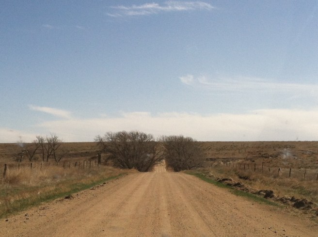
The morning went by along with several small towns, none of which had the requisite number of pickups parked in one place to signify a good Midwestern cafe. I craned my neck hard passing through Jennings–a sign read “Czech Us Out!” and I was thinking I could “Czech out” some kolaches, but no such luck, at least from what was visible passing through. Outside Selden about a mile, the highway was completely blocked off and closed (for no ascertainable reason, so…zombie invasion?). A detour forced me to backtrack east six miles, then south to Hoxie.
By the time I hit Hoxie, the wind was howling out of the north, and I was starving. I drove around town twice looking for a likely cafe, and stopped at one on the main drag where, fighting gusts, I managed to exit my car and order what was bar-none the worst hot beef sandwich of my entire life. Hints were there, of course, in the multiple blaring TV screens and coffee “whitener” nestled next to the fake sugar packets. The artificial potatoes were so cheap, they didn’t even bother adding potato flavor, and don’t get me started about the gravy. Just awful.
But, like a good Midwesterner, I ate it, said it was “fine,” and got back on the road, vowing to snack on gas station crap rather than letting myself get desperate enough to repeat that experience. If I’m going to take time to stop and eat, I’d like it to taste better than dried out chemical-laden “croissandwiches” from a rotating warmer cabinet by the highway.
To get back on my intended route, I needed to head west, and west was getting really, really difficult with sustained winds in the 40mph range. Tumbleweeds attacked by the dozens, and semi trailers noticeably shuddered in the gusts. At Oakley, I gassed up–and gave up–on the Colorado route, letting the Kansas wind capture me and sail me straight south.
And what a blessing that turned out to be. “Everybody likes to hate on Kansas,” a friend from there exclaims. I guess it’s probably like Nebraska in that its attractions are not well-known, and it’s in the way of getting to “cooler” states like Colorado and…um, Colorado. Heading straight down the west side of Kansas not only gave me ten extra miles per gallon, but the definitive knowledge that there are, in fact, some really cool things to see there.
The first one is Monument Rocks National Natural Landmark. You might think that because it’s called a “National Landmark” that it’s nicely accessible with a paved parking lot and clean restroom facilities. Actually, it’s located on private property seven miles off the pavement and over a couple of cattle grates (which means, yes, there are cattle grazing in and around the limestone formations). There are no facilities other than what you might’ve brought with you. And it’s really, really cool.
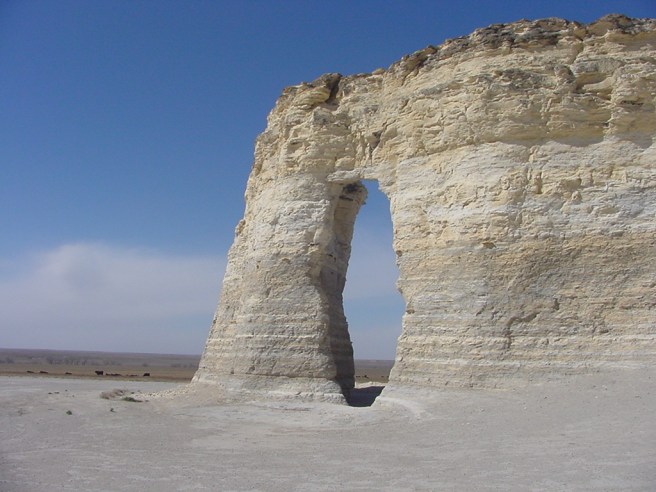
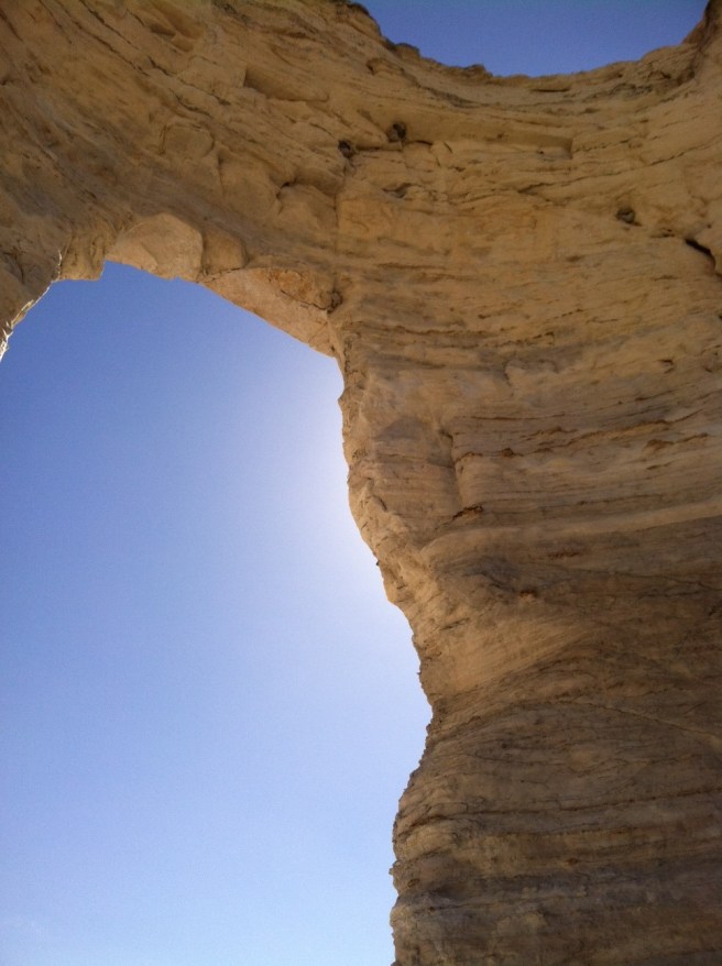
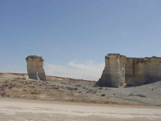
Out there in the wind and sun, being blasted by limestone eroding off the formations, it’s worthwhile to remember that you’re standing at the bottom of what was once a vast inland sea. Though, you might not know it unless you have some grounding (heh–get it?) in geology, or you stop at the information kiosk on the main highway–because there are no signs out here except those that tell you not to climb on the rocks.
Back on the highway, I traveled a few more southerly miles before dropping down into Scott State Park, nestled in a canyon and situated around a pretty, spring-fed lake. The park staff were all in the office when I walked in, and provided my $5 day pass along with lots of maps, information, and suggestions of other points of interest along my route. But the purpose of my visit there had less to do with the lake or getting out of the wind (that was really nice) than visiting the northernmost pueblo ruins in the United States.
That’s right–they’re in Kansas.
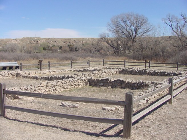
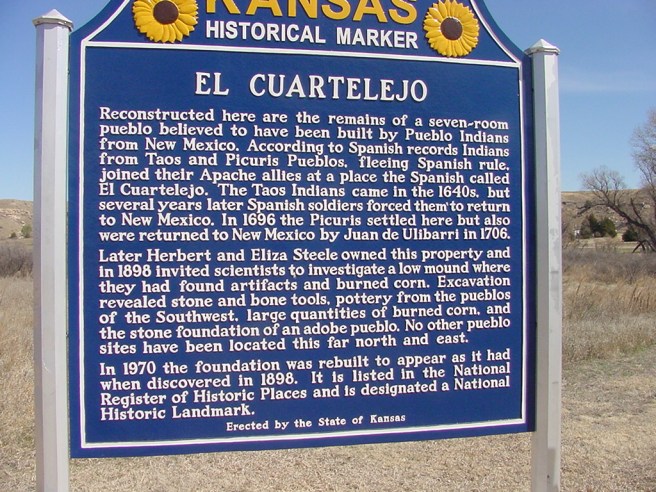
El Cuartelejo (as it’s now known) was constructed around 1664 by a group of Taos Indians fleeing Spanish rule. It was inhabited by a few other groups before being abandoned in the 1700s and later re-discovered by white homesteaders on the land, excavated, and the foundation reconstructed.
The foundation itself was not as interesting to me as the story–more unknown than known–and standing right there on land settled three-and-a-half centuries ago by people who were a long, long way from home. What was their journey like? How long did it take? Why did they travel so very far north? And, turning slowly around to take in the landscape, what factors are visible to me that helped them decide on just this location to build a “permanent” resting place?
The third stop I made that early afternoon was one I would not have bothered with had it not been for the state park staff. “Battle Canyon” is only a couple of miles down the road from the park office, and it didn’t appear on my maps. It looks to be on private property, but there is an information kiosk and guest register across a cattle grate and at the foot of a short, but winding, washed out, and rocky road to the monument on top.
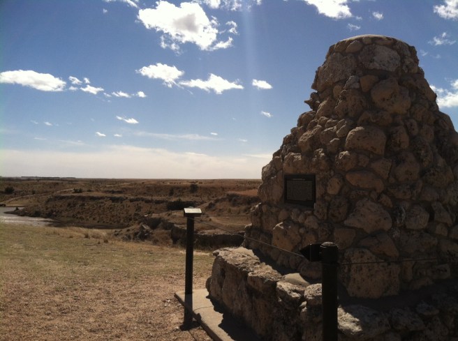
Having had my butt in a car seat for much too much of the day already, I strapped on my hiking boots and did a little climbing down in the canyon, which is reputed to be the site of the last Indian battle in Kansas–between the U.S. Army and a band of Northern Cheyenne that had been removed to a reservation in Oklahoma and got fed up (no pun intended) with the sickness and starvation there, so decided to head back home (against the government’s wishes) to Wyoming, where they could take care of themselves.
 There’s a lot of “wild west” anti-Indian bull-crap still out there, even in today’s supposedly enlightened world, so I was really pleased to read the handout on the “Battle of Punished Woman Fork,” which was written from the perspective that, hey, this band of Northern Cheyenne was being starved and sickened by genocidal U.S. government policies, and they did what they had to do for the good of their people, despite being chased down, attacked, and killed for trying to get home. And at least in the battle that took place here–they won.
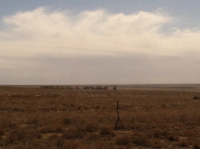
Getting back in my car and looking at the time, I realized that as cool as western Kansas was, if I wanted to be in New Mexico by nightfall, I needed to put some serious miles under me. I made it past Garden City (which is as lovely as the name suggests) and into a landscape that starts to look more and more like the southwest–irrigated wheat fields giving way to sagebrush plains and feedlots with their haze of pulverized manure dust. Near Sublette, with the wind dying down, I picked up U.S. 56 and resumed a somewhat westerly route through Cimarron National Grassland, and into the Oklahoma Panhandle.
Next installment: Out of the Panhandle and Into Enchantment.

One thought on “Road Trip Part Two: Captured By Kansas”